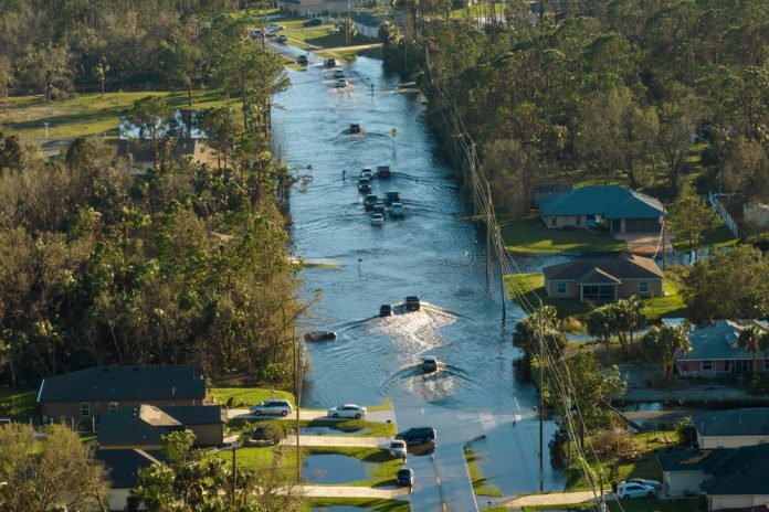
Flooding has emerged as one of the most destructive natural disasters, with damages and disruptions escalating over recent decades due to climate change and urbanisation.
Researchers from the University of California, Irvine, and the University of Bristol are emphasising the need to abandon outdated methods of flood hazard mapping, specifically a technique known as “bathtub modelling.”
By adopting more advanced methods, scientists aim to improve the accuracy and reliability of flood risk assessments, which are essential for communities, governments, and industries.
The importance of accurate flood modelling
Accurate flood modelling is crucial for managing the growing risks posed by climate change. Inaccurate models not only undermine public trust but can also hinder progress in several key areas.
Communities depend on reliable projections to understand their vulnerabilities and take action to protect themselves. Policymakers and insurers rely on accurate data to allocate resources and develop infrastructure that can withstand future flood events.
Furthermore, trustworthy models are essential for implementing equitable and effective flood mitigation strategies. Without accurate assessments, resources may be distributed inequitably, leaving vulnerable populations at greater risk.
Economic stability also hinges on accurate modelling, as businesses in flood-prone areas require precise risk assessments to make sound operational and investment decisions.
By transitioning to advanced modelling techniques, scientists can provide a more accurate and comprehensive picture of flood risks.
This, in turn, empowers communities, governments, and industries to take meaningful and evidence-based actions to mitigate the impacts of flooding.
The problem with bathtub modelling
Bathtub modelling, a method that assumes floodwaters spread evenly across affected areas like water filling a bathtub, has long been used to visualise potential flood impacts.
While straightforward and visually intuitive, this method often fails to represent the complexities of real-world flooding.
This technique does not account for key factors that influence flood behaviour, including the role of storm drains, levees, and pumping systems that manage water flow.
Additionally, it overlooks tidal amplification, the impact of rising groundwater, and the friction and dynamics that shape flood events.
As a result, bathtub models can both overestimate and underestimate flood risks, leading to unreliable hazard maps.
The researchers point out that studies using bathtub modelling often produce critical success index (CSI) scores below 0.5.
This score, which measures the accuracy of flood extent predictions, indicates that bathtub models perform worse than a random classification.
The authors argue that models need a CSI of at least 0.65 to be locally relevant and useful for practical applications.
Misleading projections and their impact
The limitations of bathtub modelling are compounded by the way its results are sometimes presented to the public.
Dramatic visualisations of flooded cities, often based on oversimplified data, can mislead policymakers and the public about the true risks of flooding.
While these images may attract attention, they fail to provide actionable insights, potentially leading to poor decision-making.
For communities in flood-prone areas, inaccurate models can erode trust. If projections do not align with lived experiences, residents may be less likely to prepare for future risks.
Conversely, exaggerated forecasts can create unnecessary panic or lead to inefficient allocation of resources for flood defences. These missteps emphasise the need for more precise flood risk assessments to guide policy and planning effectively.
A call for change
The researchers behind this study stress that the climate science community must move away from outdated approaches like bathtub modelling.
While these methods have been widely used for their simplicity, their inaccuracies make them unsuitable for the growing challenges posed by climate change and rising sea levels.
Improved modelling techniques are needed to produce trustworthy flood hazard maps that can guide mitigation strategies, inform policymaking, and empower communities.
Without accurate and reliable models, efforts to adapt to increasing flood risks may fall short, leaving people and assets vulnerable to devastating impacts.
As the frequency and severity of flooding events continue to rise, ensuring that projections are both scientifically robust and practically relevant is more important than ever.
By adopting more advanced methods, scientists can provide the tools necessary to build resilience in the face of a changing climate.


