Developments in satellite technology enabling real-time intelligence and advanced data analysis will allow for enhanced disaster response and defence operations.
In the era of the new space economy, space exploration and applications are becoming more commercially driven. This means technologies with civilian uses can be funded and developed, with potential military applications down the line.
This expands the market for space products and services targeted at addressing civilian as well as defence concerns.
Satellite Earth observation (EO), space-based satellite communication (SatCom), and onboard artificial intelligence (AI) processing are revolutionising disaster response and national defence.
While the goals differ – saving lives and protecting citizens in the civilian sector versus safeguarding national security in the defence sector – the underlying technological needs for both sectors exhibit significant overlap, offering opportunities for synergy and cost-effective solutions.
This report delves deeper into this convergence, focusing on flood disaster response as a compelling case study for its dual-use applicability.
Common technological needs: A more detailed examination
Real-time data acquisition and analysis: A time-sensitive imperative
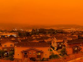
Disaster Response: During a flood event, every second counts. EO satellites equipped with various sensors, including radar, LiDAR, and optical imagers, can provide high-resolution imagery and data on flood extent, water depth, and potential infrastructure damage. However, the sheer volume of data can be overwhelming. AI-powered processing can pre-process data for faster transmission and analysis, allowing for near real-time insights. This translates into swifter emergency response, targeted resource allocation, and potentially saved lives.
Defence Applications: Similar time-sensitive pressures exist in national defence. Real-time data is crucial for situational awareness in many situations. High-resolution EO imagery can reveal obstacles to troop movements, identify potential threats, and provide vital intelligence for strategic decision-making. Advanced AI onboard defence satellites can analyse this data rapidly, allowing for faster reaction times and an operation advantage.
Reliable communication infrastructure
Bridging the gap
Disaster Response: Floods can devastate terrestrial communication networks, leaving emergency responders and affected communities isolated. SatCom offers a dependable communication lifeline in these situations. Satellite constellations provide wide-area coverage, enabling communication in areas where traditional infrastructure is damaged or unavailable. This allows emergency responders to coordinate rescue efforts, share critical information with authorities, and maintain contact with isolated communities.
Defence Applications: Reliable communication is equally important for defence forces operating in conflict zones or during deployments beyond the reach of traditional infrastructure. Secure SatCom ensures uninterrupted communication between commanders and troops, facilitating coordinated operations and the secure transmission of sensitive information.
Data fusion and predictive modelling: Leveraging AI for informed decisions
Disaster Response: The key to effective flood response lies in anticipating and preparing for potential disasters. AI-powered data fusion can combine information from EO satellites, weather data, and historical flood records to predict flood risks, identify vulnerable areas, and optimise evacuation plans. This proactive approach minimises casualties and property damage.
Defence Applications: National defence also heavily relies on data fusion and predictive modelling. AI can analyse vast amounts of data from various sources, including satellite imagery, intelligence reports, and sensor networks, to anticipate troop movements, predict obstacles, and optimise resource allocation. This allows defence forces to proactively overcome potential obstacles and maintain (inter)national security.
Flood disaster response: A case for dual-use technology in action
Pre-disaster preparedness: Mitigating risks before the storm
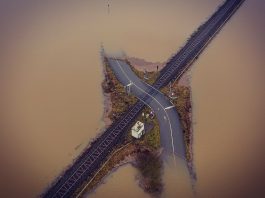
High-resolution, pre-disaster satellite imagery or numerical models can be used to create detailed flood inundation maps. AI or GIS-based analysis of these maps can identify vulnerable areas, critical infrastructure like hospitals and power grids, and potential evacuation routes. This information is invaluable for both civil authorities preparing for floods and military planners strategising for potential humanitarian assistance deployments in flood-prone regions.
Real-time flood monitoring: Guiding rescue efforts in real-time
During a flood event, EO satellites provide crucial real-time data on flood extent, water depth, and potential infrastructure damage. AI-powered on-board processing can identify areas most in need of assistance, allowing for targeted resource allocation and rescue efforts. Emergency responders can be directed to areas with stranded residents or collapsed bridges, optimising rescue efforts and saving lives.
Defence forces can leverage this same technology to monitor flood zones in areas of conflict or instability. This information can be used to facilitate operations or humanitarian interventions by identifying areas requiring immediate assistance or supporting local disaster relief efforts.
Post-disaster assessment and recovery: Rebuilding lives after the flood
Post-disaster satellite imagery helps assess flood damage to infrastructure, allowing authorities to prioritise reconstruction efforts. AI can analyse the imagery to identify damaged buildings, blocked roads, and areas with potential contamination risks from damaged sewage systems or industrial facilities.
This information is vital for both civil authorities planning recovery efforts and military forces potentially deployed to support post-disaster reconstruction. The military’s expertise in logistics and infrastructure management can be crucial in rebuilding devastated areas, and access to real-time damage assessments via AI-powered EO data is key for optimising these efforts.
Conclusion
Disaster response and national defence share a growing need for real-time data acquisition, reliable communication, and advanced data analysis. By recognising the convergence of technological needs, civil and defence sectors can leverage common solutions to optimise resource allocation, accelerate technological advancements, and ultimately save lives during floods and other disasters.
Specifically, when responding to flood disasters, near real-time flood intelligence empowers humanitarian and civilian disaster response by enabling targeted interventions, effective resource allocation, and improved coordination. This leads to a faster and more efficient response, ultimately saving lives, reducing damage, and facilitating a smoother recovery process for affected communities. For the defence sector, near real-time flood intelligence helps make informed decisions regarding troop deployment, logistics, and infrastructure management in flood zones, ultimately leading to safer and more efficient operations.
Like several other companies, RSS-Hydro is focusing some of its satellite earth observation applications (SatEO apps) more towards civil security from space, especially for ensuring a better and faster disaster response. Some of the current and future developments within RSS-Hydro’s SatEO apps have shown potential for dual-use applications, and the company is currently exploring some of these opportunities.
Please note, this article will also appear in the 19th edition of our quarterly publication.