Digital twins enable city planners to test future measures in a virtual environment, shaping urban mobility sustainably and managing it efficiently.
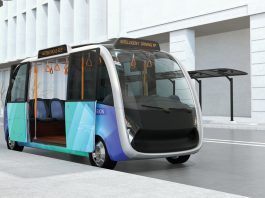
Today, an ever-growing number of new mobility solutions are enriching the range of transport services in our cities. From e-scooter to shared bikes and ride-hailing to new services we can expect to see in the future, such as autonomous shuttle buses. The entire urban mobility ecosystem is becoming increasingly complex. Only with the appropriate framework will these new services come to effectively complement existing mobility choices and benefit both citizens and the environment. So, how can cities keep maintain an overview of this changing landscape? How can they take the lead in orchestrating these new services?
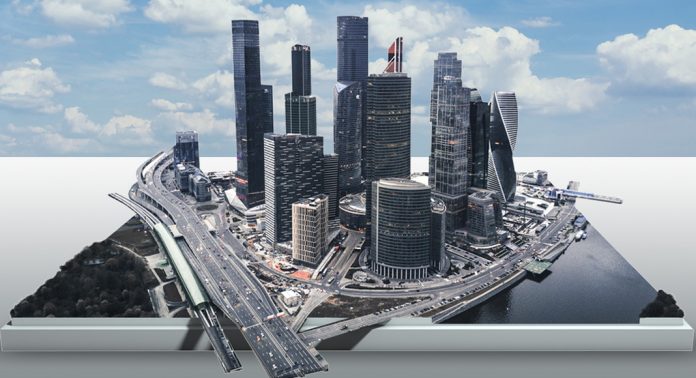
The so-called ‘digital twins’ are powerful tools that support traffic planners in shaping urban mobility sustainably and managing it efficiently. Digital twins are virtual replicas of cities or regions that can be used to run simulations before actual measures in urban mobility are implemented.
Based on Big Data and algorithms
Cities face a hundred important decisions in terms of mobility every day. How can we reduce congestion and rush hours? Where should new bike lanes be added? How can public transit be improved? Can new e-scooter providers effectively complement existing services? On the one hand, they must guarantee that people get from A to B in a comfortable, safe, and affordable way. On the other, they need to consider the economic and environmental aspects.
A digital twin enables planners to run through these questions in a virtual model and to test every possible scenario. This helps them to maintain an overview and enables them to make the right decisions, while also lowering costs and reducing the chance of failing in the real world.
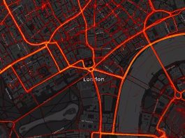
Digital twins are based on data and algorithms. In cities, lots of data is generated every day, for example by sensors, traffic cameras, or GPS. Christian U. Haas, CEO of PTV Group, the global market leader for mobility and transportation software, explained: “At PTV we use various kinds of data. This includes traffic data from all transportation modes, like cars, trucks, or public transport, but also, socio-economic data such as living areas and working areas. We refine the data, feed our algorithms with it, and build a detailed and realistic digital twin of the city.”
Digital twins are a virtual playground
In this virtual environment, all road users and their interactions, as well as public transport services, can be modelled and planned. New measures can thus be simulated and analysed before they are implemented in real life, and planners work with so-called ‘what-if-scenarios’.
If cities want to become more bicycle-friendly, for instance, then they must provide an infrastructure that allows cyclists to reach their destination safely, comfortably, and effectively. Before implementing costly infrastructure projects, it makes sense to take a close look at the various measure. What-if scenarios may include questions such as:
- Where do we need separate cycle lanes, new cycle highways, or parking spaces?
- What does the interaction with other road users look like?
- How can we provide green waves that serve cyclists?
Digital models can help to realistically simulate and analyse a city’s current and future bike traffic, to test and validate different measures and thus find the best locations for new bike lanes.
Another example is autonomous driving. What happens if self-driving vehicles are allowed onto our streets sometime soon? How will they interact with conventional vehicles? What potential opportunities and risks will this new technology have for urban and transport planning? Such questions can be addressed in the model by putting autonomous vehicles onto the virtual road. Planners and decision-makers can thus look into this unknown future and define appropriate measures at an early stage.
The Norwegian capital Oslo has conducted such a study to ensure that the city’s mobility network is prepared for the advent of autonomous vehicles. The report showed that autonomous vehicles will help reduce traffic only when integrated into a larger mobility system. But if used the same way as cars today, they will worsen the situation.
The scenario that produced the biggest reduction in traffic was where users of public transport continue to do so while car drivers switch to ridesharing. This gave a 14% reduction in traffic across the study area. Conversely, the volume of traffic would increase by 97% if everyone who currently drives and everyone who uses public transport switched to car-sharing, but without ridesharing.
Haas said: “Simulations are a kind of digital playground, where you can try out innovative ideas and concepts, which otherwise might never be tested in reality.”
Real-time traffic management
Beyond modelling and planning, digital twins of cities can be used in traffic management. By combining traffic models with real-time traffic data, traffic operators are presented with a strong tool to predict, optimise, and control traffic and transport.
Haas explained: “With our models and high-quality real-time data, precise and comprehensive forecasts for the entire traffic network are possible. Operators can predict the upcoming traffic for the next 60 minutes. Even more, in case of an incident, they get enhanced decision support.”
For example, in the event of an accident the system can provide several possible actions, such as road closure or detour, to reduce negative impacts on the network. This improves traffic flow and capacity, but also helps to increase road safety and reduce emissions.
York uses a live transport model
The city of York is the first city in the UK to use a real-time transport model for live traffic management. The digital model is integrated with over 100 live traffic flow sensors, more than 100 live signal controllers, live speed data across the network provided by TomTom, and up-to-date information about roadworks and other network changes. The model combines all of this data into a single view. The control room can then use this information to see, in fine detail, what is happening across the entire traffic network. Additionally, they can also test alternative scenarios for the hour ahead, or even days or weeks into the future. The city of York, therefore, has an operational road modelling asset for monitoring current conditions, planning for the near future, observing how plans play out, and using this knowledge to improve future strategies.
Please note, this article will also appear in the seventh edition of our quarterly publication.


