Margherita Bruscolini, Geospatial Scientist at RSS-Hydro, outlines the organisation’s SEMOR aid project, designed to improve water resources management in the flood-prone Niger River.
River and floodplain landscapes are constantly undergoing transformations caused by natural and manmade processes putting pressure on fluvial systems, such as reservoirs and hydropower dams; intensive agriculture and unsustainable irrigation methods; high-impact repetitive droughts and floods; and the overall effects of climate change. All of these factors can cause considerable changes, some of which irreversibly degrade ecosystem services, local economies and have a direct impact on lives, particularly in sensitive transitional zones, such as the Sahel region in Africa and its Niger River Basin (NRB), also exposing inequalities.
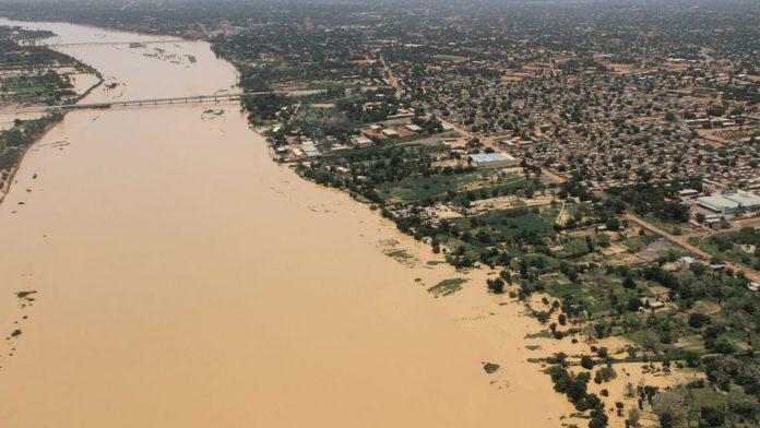
Flooding is a dramatic reality in Niger, where some of the most devastating floods took place in 2012, leaving dozens dead and impacting almost 500,000 people. Then came those of late summer 2020, said to be the “worst floods in the country’s history”, affecting over 500,000 people in one season. And the list goes on looking backward from 2021, with more than 100,000 individuals affected and thousands of homes destroyed across the country1. Each year, this area experiences an upward trend in the number of people affected by these seasonal rains and floods and the population often struggles to cope with the effects.
For many communities, recovering from the devastating impacts of natural disasters is becoming impossible. According to the UN, the number of people affected by water disasters has doubled since 2015, increasing damage, including the destruction of crops and loss of livestock. Often, the situation is so extreme that there is the need to activate the International Charter on ‘Space and Major Disasters’,2 with which various corporate entities and space agencies (ESA, NOAA, USGS, DLR, Airbus, ICEYE, Planet, and others) quickly provide satellite data to help organisations monitor emergencies.
The Republic of the Niger is facing multiple connected emergencies. Flooding and associated climate change impact projections are adding to the crises already stretching the capacity of the government and humanitarian agencies to respond. Many in the country face malnutrition, recurrent disease epidemics and outbreaks, cyclical floods, drought, and displacement. This is exacerbated by the instability in neighbouring countries, creating an influx of thousands of refugees and migrants.
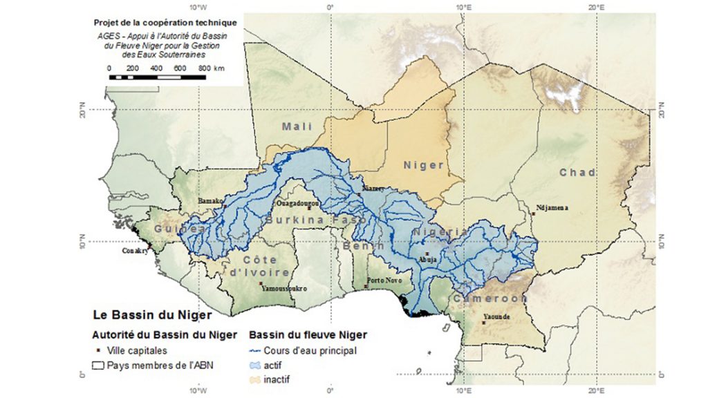
The Niger River is the main river of West Africa, with an extension of about 4,180km and a drainage basin of 2,117,700km2 in area. Its source is in the Guinea Highlands in South East Guinea near the Sierra Leone border, and it runs in a crescent through Mali, Niger, on the border with Benin, and then through Nigeria, discharging through a massive delta (the Niger Delta) into the Gulf of Guinea in the Atlantic Ocean. The Niger is the third-longest river in Africa, exceeded only by the Nile and the Congo River.
Both water resources development and management is strongly dependent on the availability of data, yet data collection and hydrometric measurements are not fully implemented in the majority of the Niger River Basin. In some parts, there is no functional hydrological station, fundamental to monitor the river, making much-needed water resources plans and missions impossible in this area unless the pressing need for data is addressed. There is also a need for institutional reforms to resuscitate the many abandoned hydrometric stations or to find alternatives, coupled with the training of local agencies and researchers in hydraulic engineering, water resources planning and management, also looking at climate change impacts in the area.
SEMOR: An innovative project
Together with regional and local public and private partners in Niger and Luxembourg, RSS-Hydro’s development aid project called ‘Space-Enabled Modeling of the Niger River to Enhance Regional Water Resources Management (SEMOR)’ aims to address the current data challenge in the Niger River Basin by proposing a low-cost and sustainable space-based ICT solution that will be transferred and maintained by the public partner institution, AGRHYMET Regional Center, in Niamey, Niger.
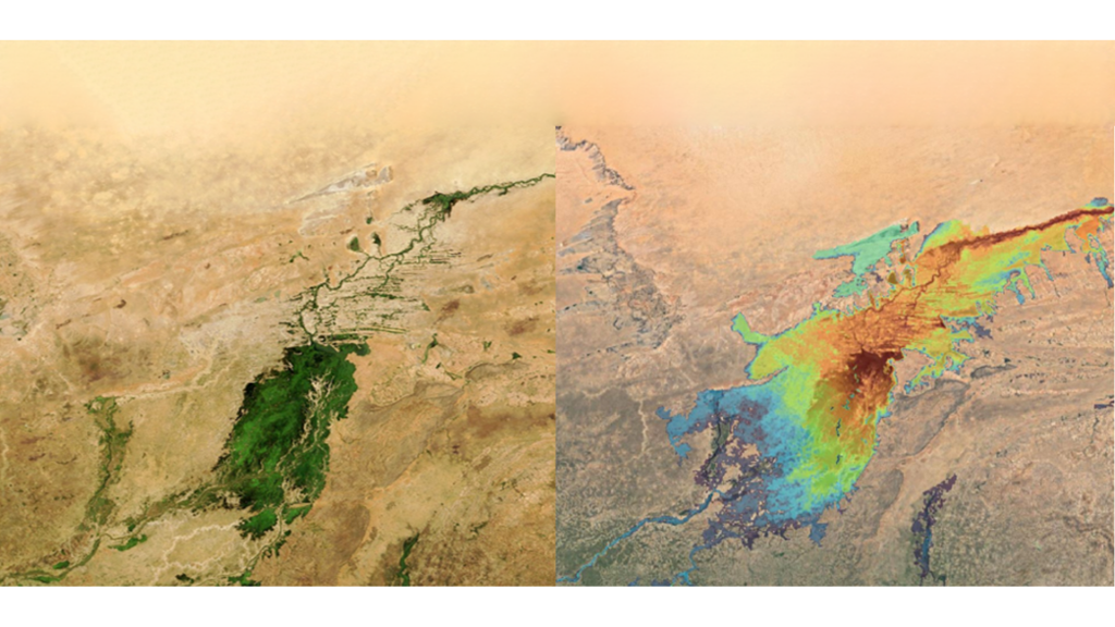
The project is co-funded by the Business Partnership Facility programme, a financing facility initiated and financed by the Luxembourg Government through the Luxembourg Directorate for Development Cooperation and Humanitarian Affairs. The consortium of experts in the fields of geospatial and sensor technologies, hydrology and climate change consists of Luxembourg-based RSS-Hydro (expert in flood modelling and mapping of water risks) and WEO (expert in Earth Observation processing and capacity building), Niger-based AGRHYMET (expert in agrometeorological, hydrological monitoring and regional training), and UK-based Riverlabs (expert in sensor network technologies development). The solution that the consortium is working on uses industry-proven, affordable small water-level sensors complemented by public, open-access satellite Earth Observation (EO) data and drones for local river and floodplain topography, to build a 2D flood inundation model as well as a sustainable river monitoring network along the Niger River Basin in Niger and potentially extended over the entire Sahel region.
The 2D flood inundation model has already been built for Mali with RSS-Hydro’s colleagues from the University of Bristol. During the project, the same underlying model input data and parameters are used to extend the model across to Niger, which is about 90% of the total length of the river and flows across several countries of the Sahel. The team uses the new data streams to extend and improve predictions of the existing flood inundation model in the NRB that will then be transitioned to the local partner that can use it to simulate events and climate change scenarios. The partners are also using open-access EO data to estimate drought patterns, identifying possible drought risks in the country. This can be done through the use of optical (ESA’s Sentinel-2) and thermal (ESA’s Sentinel-3) satellite data at a resolution of ten metres – the high resolution needed to identify different spatial drought patterns. Using openly available EO data for flood extent mapping and drought risk, it is possible to extrapolate the developed methods to other flood- and drought-affected areas in Africa, as well as globally. Another big focus of the project consists of capacity-training workshops around topics of Earth Observation, drones, and model use for water risks (floods and droughts) and climate change scenarios, organised preferably at the local partner institution in Niger.
The impacts in terms of sustainable development
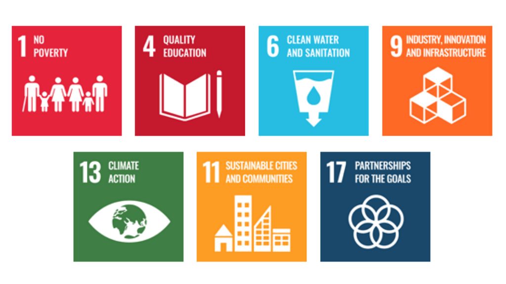
Social and environmental impacts and financial viability are key for a successful sustainable partnership and to make a long-lasting impact. In this context, the 17 UN Sustainable Development Goals (UN SDGs) can be used as a framework to promote job creation, green and inclusive growth and, more broadly, poverty reduction. More specifically in the context of the objectives, working as a consortium of international partners (SDG 17 – PARTNERSHIP FOR THE GOALS), the project aims to promote a more sustainable and efficient management of water resources (SDG 6 – CLEAN WATER AND SANITATION), to foster innovation (SDG 9 – INDUSTRY, INNOVATION AND INFRASTRUCTURE), and to make cities and human settlements inclusive, safe, resilient and sustainable (SDG 11 – SUSTAINABLE CITIES AND COMMUNITIES). Also, taking urgent action to combat climate change and its impacts, such as increasing the magnitude of water-related extreme events like floods and droughts (SDG 13 – CLIMATE ACTION), is a goal to reduce poverty (SDG 1 – NO POVERTY), while working on better communication of the risks and educating vulnerable communities (SDG 4 – QUALITY EDUCATION).
The expected project results – in relation to job creation, technology, knowledge transfer, and impact on economic development in Niger and the wider Sahel region – are manifold. The project addresses the pressing needs outlined above by supporting the fight against floods (and droughts) in the Niger River Basin by establishing a space and IoT-based river monitoring network that is sustainable and cost effective. An advanced data collection and monitoring network helps improve regional predictions of hydrological extremes, thereby increasing resilience of vulnerable communities. Working as a consortium of local and international experts and bringing substantial cost-sharing investment to the region, one of the project’s main objectives is to open opportunities for local job creation, as well as to train personnel, provide adequate equipment for the meteorological and hydrological stations networks, and set up regional and national multidisciplinary working groups to monitor the hydrometeorology as well as the crops and pastures conditions during the rainy season. In addition, our proposed river monitoring network and flood prediction model can be extended to other parts of the Niger River Basin, thereby increasing positive regional economic and environmental impacts.
Sustainable Development Goals
Partners
 References
- 2021 Niger floods, Wikipedia
2. Flood in Niger, International Charter ‘Space and Major Disasters’
Please note, this article will also appear in the ninth edition of our quarterly publication.

