In the realm of Earth observation technology, a fascinating transformation is underway.
New sensor technologies, artificial intelligence algorithms, and the trend of miniaturisation are reshaping the landscape of monitoring our planet.

From enhanced data precision to improved global coverage, the future holds a promise of unparalleled insights into Earth’s dynamics.
As you explore the possibilities that lie ahead, prepare to witness a paradigm shift in how we interact with and safeguard our environment.
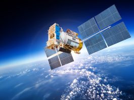
The evolution of Earth observation satellites
The evolution of Earth observation satellites has revolutionised our understanding of the planet’s dynamics and resources.
These satellites have enabled us to monitor climate changes, track natural disasters, and observe the impact of human activities on the environment.
By capturing high-resolution images and data from space, Earth observation satellites provide valuable insights into land use, deforestation, urbanisation, and more.
Over the years, advancements in satellite technology have led to improved accuracy, resolution, and global coverage.
We now have access to real-time information and historical data that help scientists, policymakers, and businesses make informed decisions.
From monitoring crop health to predicting weather patterns, Earth observation satellites play a crucial role in various fields, including agriculture, disaster management, and urban planning.
As we delve into the evolution of Earth observation satellites, we discover how these technological marvels have transformed our ability to study and protect our planet’s precious resources.
Key technological innovations in remote sensing
Advancements in remote sensing technology have significantly enhanced the capabilities of Earth observation satellites, enabling more precise data collection and analysis.
One key technological innovation in remote sensing is the development of hyperspectral imaging. This technology allows satellites to capture images across hundreds of narrow spectral bands, providing detailed information about the composition of Earth’s surface.
Additionally, the use of light detection and ranging (LiDAR) technology has revolutionised remote sensing by enabling the measurement of elevation with exceptional accuracy.
Another critical advancement is the integration of synthetic aperture radar (SAR) systems into Earth observation satellites.
SAR technology allows for all-weather, day-and-night imaging capabilities, making it invaluable for monitoring changes in the environment, such as deforestation and urban development.
Furthermore, the miniaturisation of sensors and the use of advanced signal processing techniques have improved the spatial resolution of satellite images, allowing for more detailed and comprehensive monitoring of Earth’s surface.
These technological innovations in remote sensing continue to push the boundaries of what we can observe and understand about our planet from space.
The role of small satellites and CubeSats
Small satellites and CubeSats play a crucial role in expanding the reach and capabilities of Earth observation technology.
These small spacecraft have gained popularity due to their cost-effectiveness, agility, and ability to work collaboratively with larger satellites.
Small satellites, typically weighing between 1-500 kg, and the even smaller CubeSats, weighing around 1.33 kg per unit, are revolutionising Earth observation missions by providing more frequent and varied data collection opportunities.
One significant advantage of small satellites and CubeSats is their ability to form constellations, working together to cover larger areas or revisit specific locations swiftly. Their compact size allows for easy integration into launches alongside larger payloads, reducing overall mission costs.
Despite their small stature, these satellites are equipped with advanced sensors capable of capturing high-resolution imagery and other data crucial for Earth observation applications.
As the demand for real-time data and frequent monitoring increases, small satellites and CubeSats are becoming indispensable tools for researchers, governments, and industries seeking timely and cost-effective Earth observation solutions.
Integration of next-generation sensors and AI algorithms
Incorporating cutting-edge sensors and AI algorithms enhances the functionality of Earth observation technology.
Next-generation sensors such as hyperspectral cameras and synthetic aperture radar systems provide higher resolution imagery and greater data accuracy.
These sensors can detect minute changes in the Earth’s surface, enabling detailed monitoring of environmental changes, urban development, and natural disasters.
AI algorithms, on the other hand, process vast amounts of data more efficiently, allowing for quicker analysis and extraction of valuable insights.
By combining advanced sensors with AI capabilities, Earth observation satellites can detect patterns, predict trends, and even autonomously adjust their data collection strategies based on real-time information.
This integration not only improves the accuracy and speed of data processing but also enhances the overall capabilities of Earth observation systems, making them indispensable tools for environmental monitoring, disaster response, and resource management.
The synergy between next-generation sensors and AI algorithms opens up new possibilities for Earth observation technology, revolutionising how we understand and interact with our planet.
Future trends: What’s on the horizon for Earth observation technology?
Looking towards the future, Earth observation technology is poised to undergo significant advancements that will further revolutionise how we monitor and interact with our planet.
One key trend on the horizon is the development of hyperspectral imaging capabilities. This cutting-edge technology will allow for more precise identification and analysis of Earth’s surface materials, vegetation health, and environmental conditions.
Additionally, the integration of quantum sensors holds promise for enhancing the accuracy and efficiency of data collection, enabling us to gather information with unprecedented detail and speed.
Another exciting trend is the increasing use of machine learning and artificial intelligence algorithms in processing vast amounts of Earth observation data.
These technologies will enable automated analysis, pattern recognition, and predictive modelling, empowering us to extract valuable insights from the overwhelming volume of information captured by satellites.
Furthermore, advancements in miniaturisation and the deployment of constellations of small satellites will expand global coverage, improve revisit rates, and facilitate real-time monitoring of dynamic environmental processes.
Embracing these future trends will undoubtedly propel Earth observation technology into a new era of innovation and utility.
In conclusion, the future of Earth observation space technology is incredibly exciting. With advancements in sensors, AI algorithms, and miniaturisation, we’re on the brink of revolutionising how we monitor and understand our planet.
The integration of hyperspectral imaging, quantum sensors, and machine learning, coupled with small satellite constellations, will enable more precise data collection and analysis.
These developments will undoubtedly enhance our ability to address environmental challenges and better manage Earth’s resources.
The future of Earth observation technology is bright and full of potential.