The ANERIS project integrates different marine life-sensing technologies to implement the new concept of Operational Marine Biology.
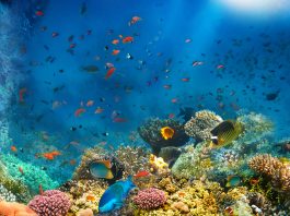
The ongoing biodiversity crisis may result in much of the ocean’s biodiversity being lost or deeply modified without even being known. As the climate and anthropogenic-related impacts on marine systems accelerate, biodiversity knowledge integration is urgently required to evaluate and monitor marine ecosystems and to support suitable responses to underpin a sustainable future. Biological observations need to improve radically to enhance our understanding of marine ecosystems and biodiversity under long-term global change and multiple stressors.
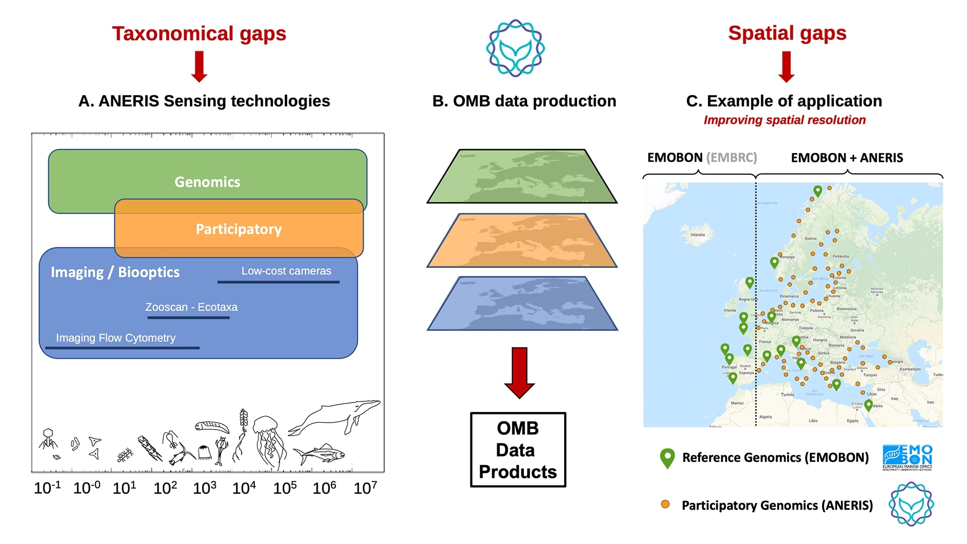
However, this is not trivial, as biological properties are more difficult to measure and integrate compared to physical or chemical parameters. The EU-funded project ANERIS proposes to implement the concept of Operational Marine Biology (OMB), understood as a biodiversity information system for systematic and long-term routine measurements of the ocean and coastal life and their rapid interpretation and dissemination. The OMB information flow is summarised in Fig. 1.
Creating a new operational system for marine biology
The achievement of the new Operational Marine Biology system is a key goal for the next decade and will enable a baseline of biological information related to Essential Biodiversity Variables (EBVs) and Essential Ocean Variables (EOVs). It will also deliver critical data for Marine policy descriptors, in particular the Marine Strategy Framework Directive (MSFD).
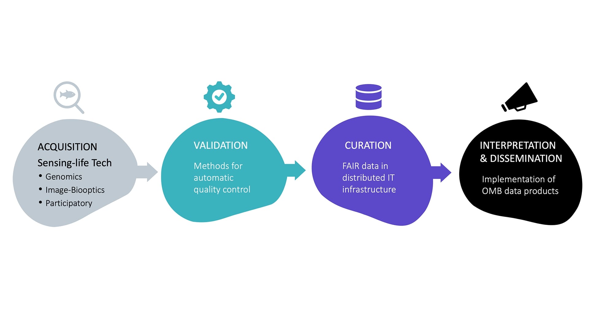
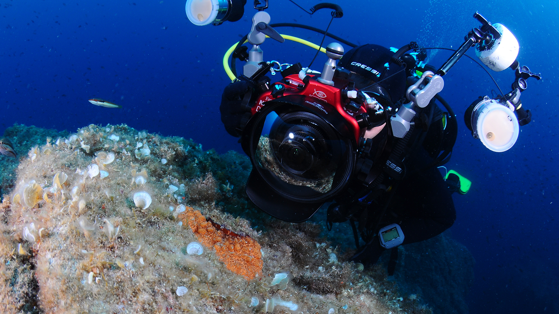
The design of the new instruments and methods will integrate different types of marine life-sensing technologies: genomics, imaging-biooptics and participatory sciences. The technologies will be implemented in a co-design framework involving all the relevant stakeholders: academia, industry, civil society, and government.
The production of FAIR Operational Marine Biology data will be carried out in a distributed IT infrastructure built from edge and cloud compute nodes to be connected with the European Open Science Cloud (EOSC).
The technologies will be tested and validated in different case studies involving the ANERIS innovations and commercial instruments to be improved in different European research infrastructures: LifeWatch-ERIC, EMSO-ERIC, EMBRC, Euro-BioImaging and the European Grid Initiative. The project will develop a training programme for the operation and use of these new solutions for all the involved stakeholders, particularly the research infrastructure staff.
Overall, the project proposes to benefit all the actors involved in the quintuple helix framework of innovation, promoting innovation and knowledge sharing among them:
- The academy with new life-sensing technologies to use in research,
- The industry with new technologies and methods to exploit,
- The governments, with improved observational systems to take decisions,
- The society with a more active role in monitoring marine species,
- The environment with better conservation policies.
The ANERIS networks
ANERIS will take advantage of the existing networks in which different partners coordinate or collaborate:
- EMO BON: European Marine Omics Biodiversity Observation Network, coordinated by EMBRC. It will provide the reference measurements for genomic-based observations.
- MedCities 67 local authorities from all shores of the Mediterranean basin will be connected to ANERIS outcomes.
- Ocean Cities will connect ANERIS with a worldwide network supported by the UN Decade of Ocean Science for Sustainable Development.
- The Atlantic Network of Intertidal Monitoring will provide all the sites to validate the proposed ANERIS technologies in completely different habitats than the ones explored in the Mediterranean sites.
Complementing these networks, the Catalan Federation of Underwater Activities (FECDAS) is promoting, as an ANERIS partner, the participation in different project activities and events. The Federation is acting as a bridge between different SMEs linked to the Blue Economy (diving clubs, snorkel guides, etc.) and the volunteers interested in being involved in the ANERIS participatory technologies. FECDAS is involved in training activities to explain the different technologies and engaging both SMEs and volunteers to strength the networking activities and the engagement events planned in the project.
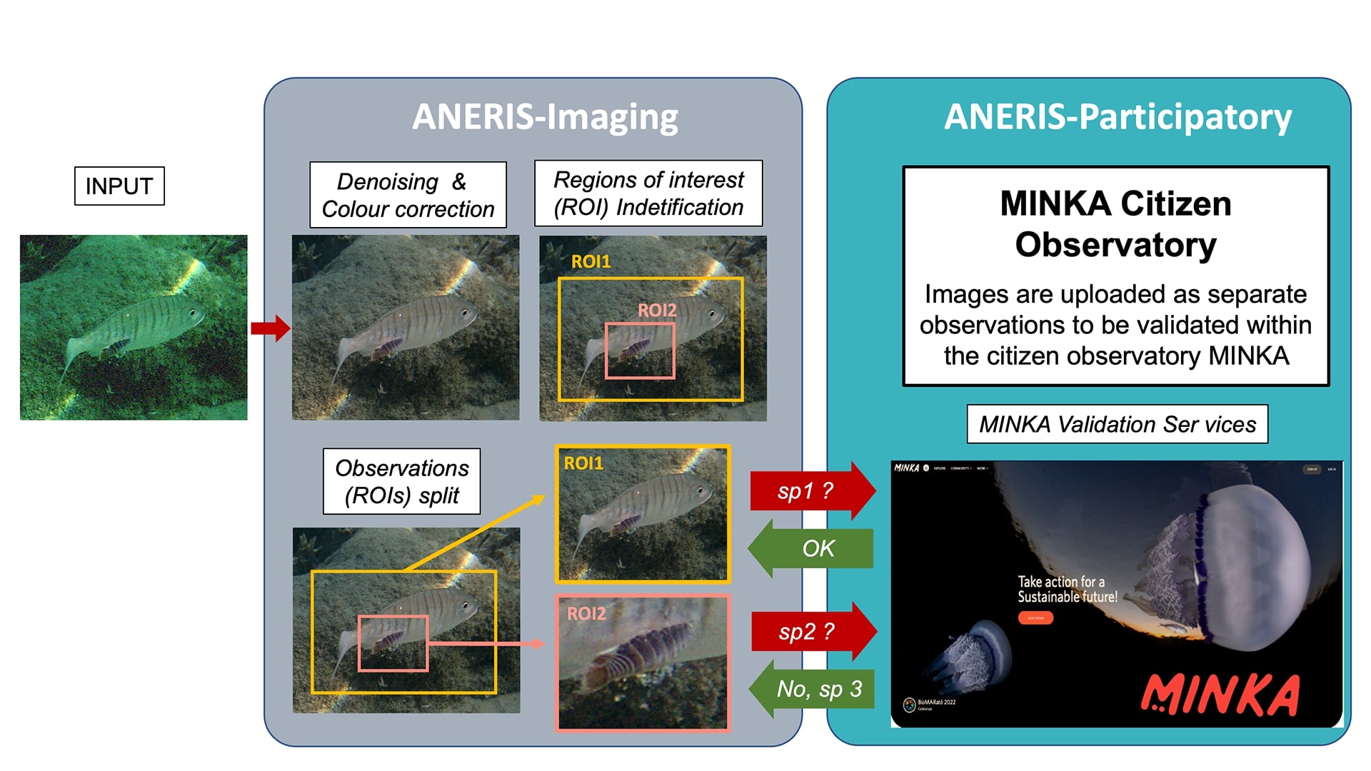
Fig. 3 shows an example of a pipeline of different technologies proposed in ANERIS. Different advanced imaging technologies for automatic denoising and colour correction, combined with the method of identifying Regions of Interest (ROI), could provide the final images for each organism identified in one image. This could facilitate and significantly improve the process of reporting and validating observations in citizen observatories, which will promote a substantial increase in participation from the volunteers.
ANERIS first results
One of the first outcomes from ANERIS was the consolidation of a community of practice for volunteer reporting in the first pilot study around the Catalan Coast. As a first result, the data set of marine biodiversity achieved more than 100,000 validated observations during the first year of the project (2023), as reported in the news from the Institute of Marine Sciences. At present, the dataset has more than 250.000 validated observations.
This massive number of observations has been achieved as a combination of the participatory technologies, in particular the MINKA observatory platform, which provides dedicated services for collaborative reporting and validation, and the engagement strategies developed and improved in the project. The proposed engagement strategies consider citizen science projects as a collaboration between multiple stakeholders to ensure long-term volunteer engagement. These stakeholders include volunteers, but they also have new roles, such as enabling communities that act as a bridge between different communities (volunteers, academia, SMEs). In this pilot study, the role of enabling community has been taken by the Catalan Federation of Underwater Activities (FECDAS), connecting diving clubs and different SMEs linked to scientific tourism and sea-watching activities with the volunteers.
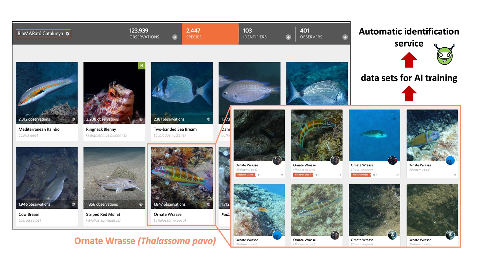
The success of this pilot study may provide high-resolution maps, both in space and time, of the species distribution from the reported volunteer observations. Furthermore, the high number of images reported by the volunteers for each species allows the creation of excellent datasets for training AI-based systems for automatic validation and identification (Fig. 4). This hybrid-AI technology is one of the innovative services included in the project.
The pilot study will be used as a reference to scale up this approach to larger regional areas (the whole Mediterranean and other European Seas). The final goal is to produce one of the first Operational Marine Biology Data Products based on volunteer participation.
Please note, this article will also appear in the 22nd edition of our quarterly publication.