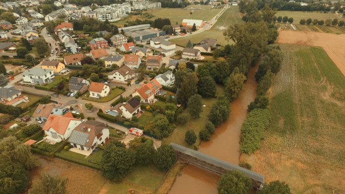
RSS Hydro Geoscientist & UAV Pilot, Margherita Bruscolini, discusses the necessity of understanding the components of disaster risk and how this will facilitate the design and application of effective disaster risk management strategies, as well as spreading awareness among the population and improving the resilience of communities at risk.
There is no denying that extreme climate events – such as flooding – have a strong and long-lasting impact on people’s lives. They can force you to move away from your shelter, full of memories accumulated during the years, perhaps the result of hard work and sacrifices, your home. The consequences of water-related extreme events on someone that is not prepared are not only material, with visible damages to objects and economic losses, but above all they are mental, hence more subtle and not easily surmountable. Not to mention the multifaced emotional dimensions of the environmental crisis and the so-called “climate anxiety”, the popular term indicating the state of distress or worry about climate change and its effects, very frequent in young people.1 Feelings of terror and impotence are a quite common consequences of natural disasters, the extreme events that are increasing in frequency and magnitude and are aggravated by climate change and intense urbanisation.
The tragic 2021 floods around Western Europe2, 3 and China4 are no exception in terms of damages and devastating loss of lives, with more than 200 victims claimed in Europe, more than 50 in China and people still missing. What is surprising is how such devastation could be inflicted in 2021, upon some of the world’s wealthiest and technologically advanced countries, despite the consistent investments in preparedness and flood control after previous inundations.5
These events have raised legitimate questions on the accessibility, distribution, and correct use of the flood forecasting systems around Europe, showing that there is still a lot to do. In fact, as Jeff Da Costa points out,6 the early warning from the European Flood Awareness System (EFAS) were in place but were often not effectively issued to populations, that were not prepared to face the flooding and, in some cases, had to evacuate when it was too late.
If there is a lesson that we can learn from these catastrophic events, it is that, even if we are improving our abilities to forecast extremes events, the same cannot be said for communicating the risk and spreading the alert, or at least not everywhere. For this reason, we need to act and invest more time and resources on building a more uniform communication system on a regional, national, and European level. We also need to educate people on disaster risk and its three components: hazard (a source of potential harm or a situation with a potential to cause loss), exposure (the valued societal elements, such as people and buildings, in an area in which hazard events may occur), and vulnerability (the propensity of exposed elements such as human beings, their livelihoods, and assets to suffer adverse effects when impacted by hazard events). Risk and its components are not fixed but a continuum in constant evolution.7 Understanding the multi-faceted nature of risk components can help not only in designing and applying effective adaptation and disaster risk management strategies, but also in spreading awareness among the population and improving the resilience of communities at risk.
Since the start of the flooding events in Belgium, Luxembourg, Germany, France, and the Netherland, the team at RSS-Hydro has been working hard to produce complete flood risk analysis and maps using different geospatial technologies for several areas affected. To help protect the population, RSS-Hydro designs maps that show flooded buildings in towns and cities at high—resolution, also taking into account the consequences of climate change by considering the four main simulated CO2 emission scenarios in climate projection models. This kind of maps help not only to better understand the flooding extent and the impact on properties, intimately linked with people’s well-being, but also the development of the risk areas that need to be considered in spatial planning. Satellite imagery, for example the Copernicus Sentinel-1 SAR (Synthetic-Aperture Radar), can be used in combination with field observations, drone data, and computer simulations to take action, increase the population well-being, and raise awareness.
References:
- The impact of climate change on mental health and emotional wellbeing: current evidence and implications for policy and practice. Imperial College London, 2021.
- 2021 European floods. Wikipedia, 2021.
- Floods in London are the latest sign big cities aren’t ready for climate change. CNN, 2021.
- Death toll rises and thousands flee homes as floods hit China. The Guardian, 2021.
- Europe’s deadly floods leave scientists stunned. Science, 2021.
- Report from Europe’s flood zone: researcher calls out early warning system gridlock amid shocking loss of life. The conversation, 2021.
- Determinants of Risk: Exposure and Vulnerability. Managing the Risks of Extreme Events and Disasters to Advance Climate Change Adaptation. IPCC, 2012.


