Professor Kevin P Furlong from the Geodynamics Research Group at Penn State University describes how his team are developing a better understanding of subduction zone earthquakes.
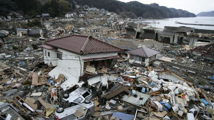
Although the term ‘subduction zone’ is probably not particularly familiar to most people, almost everyone knows of the devastation that can be generated from these plate tectonic boundary zones. Beginning with the death and devastation across the Indian Ocean Basin from the 2004 ‘Boxing Day’ (26 December) earthquake and tsunami, and followed by the 11 March 2011 Tohoku, Japan earthquake and tsunami, we have all become too familiar with the awesome power of a subduction zone earthquake.
Motivated by these events and the increasing availability of high-resolution data that can monitor crustal motions and micro-earthquake activity along these boundaries, subduction science is developing into a primary focus area for geoscience and natural hazard studies. Subduction zones, where one tectonic plate converges and dives beneath another, have long been understood to be capable of generating massive earthquakes and associated ocean-crossing tsunami. Since the development of the plate tectonic theory in the latter half of the 20th century, the general mechanism within subduction zones that can produce these great earthquakes (greater than Magnitude 8) has been recognised to be, like other faults, a consequence of fault locking leading to strain build-up that finally overcomes the strength of the locked section and a major earthquake ensues.
Advancing our understanding
Between the development of plate tectonics and the turn of the 21st century, there were few of these great subduction zone earthquakes – prior to the 2004 Indonesian earthquake, the last comparable earthquake was the 1964 Alaska earthquake. So, although theory developed to explain subduction zone processes, there was little direct data from major events to help constrain and advance our understanding.
This all changed on 26 December 2004, when the subduction zone off northern Sumatra ruptured and produced a devastating tsunami. With this event, and a series of other very large earthquakes since 2004, we have found that our pre-2004 models were inadequate to explain the actual processes, and that the behaviour of a subduction zone before, during, and after major earthquakes provides significant information to advance our understanding of this lurking hazard.
Tools and modelling
This 21st century suite of subduction zone earthquakes has been observed using a range of geophysical tools that place quantitative constraints on the rates, locations, and timing of crustal deformation throughout the earthquake cycle. The deployment of GPS observing networks in Japan, western North America, Chile, and other subduction regions coupled with detailed seismological imaging and satellite-based tools that can quantify crustal displacements has identified previously unrecognised patterns of crustal deformation that are characteristic of different parts of this subduction zone earthquake cycle.
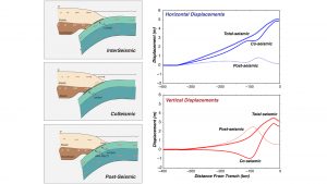
In our subduction science research in the Geodynamics Research Group at Penn State University, we have focused on understanding the implications of the patterns of crustal deformation through the earthquake cycle for the nature of earthquake rupture. In particular we have combined numerical modelling of the subduction system with observations from GPS, seismology, and other subduction zone observing systems to determine the extent of potential rupture (a major component of earthquake magnitude).
Each major subduction earthquake has its unique character, some rupture only small patches of the plate boundary, while others – those that are the great earthquakes – rupture from the trench to the base of the locked zone. Our work is aimed at better defining the distribution and extent of these locked patches (termed ‘asperities’), determining how they interact with each other, and exposing the signature of these characteristics. We are finding that the signal we can observe (through GPS or other tools) reflects the interaction of both deformational processes along the plate boundary and the nature of the crust above the subduction zone, where we make our observations. With this understanding, we can begin to remove the obscuring effects of that crust and focus on the processes along the plate boundary.
Through a combination of improved observations, detailed numerical modelling, and an understanding of the geology of the tectonic plates involved, we are advancing our understanding of subduction zone earthquakes. Subduction science requires integrating across a wide range of sub-disciplines, but with the combination of high-resolution data and integrative models our understanding of the earthquake hazard along subduction zones is advancing. Since we cannot stop the plates from moving, we will not be able to stop these earthquakes, but a better understanding of the earthquake potential along each section of a subduction zone can provide an informed foundation upon which to act.
Please note, this article will also appear in the sixth edition of our quarterly publication.

